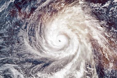
Why did the season fall so far short of the early predictions that, preseason, forecast up to 17 named storms, including nine hurricanes, and Atlantic Basin and US land-falling hurricane activity as high as 60% above the 1950-2005 norm? By August, forecasts were already being downgraded, with a growing Pacific El Nino cited as the cause of quieter then expected activity.
Another reason for the subdued season seems to have been a particularly vigorous Saharan air layer or SAL. This is an elevated layer of hot, dry, dust laden air that periodically pushes westwards from the Sahara across the eastern tropical Atlantic - the main breeding ground for Atlantic hurricanes. In 2006, the SAL covered much of this region, where its very dry air, temperature inversion and strong wind shear acted to break up tropical disturbances and hinder hurricane intensification.
The result was just nine named storms, of which only five achieved hurricane status. This is two-thirds less than in 2005, which saw a staggering 28 named storms, of which 15 developed to hurricane strength. Those living in the hurricane belt and those insurers and reinsurers who are currently rubbing their hands with glee should, however, make the most of the lull. We could well see a return to far more lively conditions in 2007.
Philip Klotzbach and William Gray at Colorado State University also attribute a large portion of their over-prediction for 2006 hurricanes to a late developing El Nino and increased mid-level dryness in the tropical Atlantic. Their paper on the 2006 hurricane season is available at www.hurricane.atmos.colostate.edu/Forecasts/2006/nov2006.


